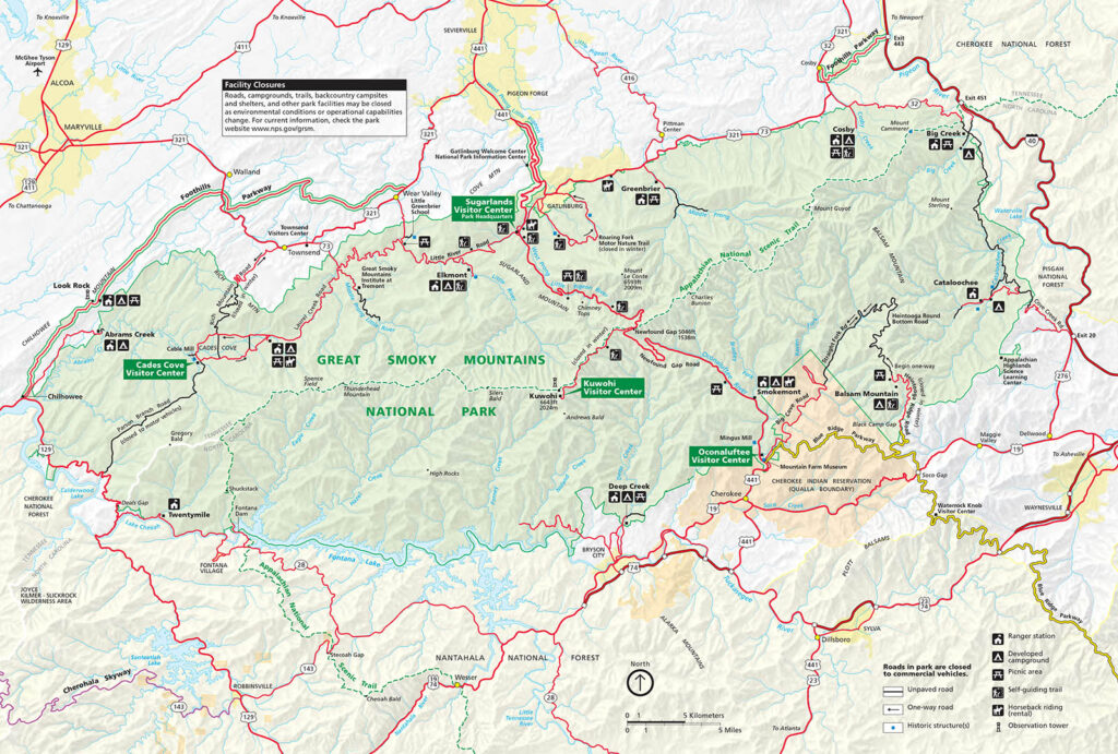
The Great Smoky Mountains National Park offers a vast network of hiking trails with varying distances, difficulty levels, and scenic attractions. You can see them all on the Great Smoky Mountains National Park map below:
- Laurel Falls Trail: This popular trail is 2.6 miles round trip and offers a paved path with a moderate incline. It leads to the stunning 80-foot Laurel Falls.
- Alum Cave Trail: A 4.4-mile round trip trail that takes you through scenic landscapes and leads to the Alum Cave Bluffs, offering beautiful views.
- Abrams Falls Trail: This 5.2-mile round trip trail leads to the 20-foot Abrams Falls along the Abrams Creek. It is a moderately difficult trail with some steep sections.
- Charlies Bunion Trail: A challenging 8-mile round trip trail that rewards hikers with breathtaking views from the iconic rock outcrop named Charlie’s Bunion.
- Ramsey Cascades Trail: This strenuous 8-mile round trip trail takes you to the tallest waterfall in the park, Ramsey Cascades, which drops 100 feet.
- Grotto Falls Trail: A 3-mile round trip trail that leads to the picturesque Grotto Falls, where you can walk behind the waterfall.
- Rainbow Falls Trail: A moderately challenging 5.4-mile round trip trail leading to the impressive 80-foot Rainbow Falls, known for producing rainbow-like mist on sunny days.
These are just a few examples of the many hiking trails available in the Great Smoky Mountains National Park. Before your visit, check out this detailed Great Smoky Mountains National Park hiking trail map to choose the trail best suited for your fitness level and interests. It’s also important to be prepared with proper hiking gear, water, and snacks, and to follow all safety guidelines provided by the park.

Click Here for Printer Friendly Version, High Resolution PDF Format Size
Page Summary: High Resolution Map of the Great Smoky Mountains National Park, Great Smokey Mountains Map.
